There is no favorite listings!

Fall River

Fall River, Nova Scotia

Fall River’s name is derived from a stream running between Miller Lake and Lake Thomas which had a waterfall. These falls supplied water power for several mills during the 19th century as well as a local electrical utility during the early 20th century. The waterfall was demolished in the late 1950s as a result of the construction of the 102 or Bicentennial Highway leading to Halifax; the waterfall was located where the 4-lane expressway currently runs up the hill from the crossing of Lake Thomas to the interchange with Highway 118 at Miller Lake.

The Mi’kmaq Nation and its predecessors were known to have inhabited Fall River prior to European settlement, using the waterways for a portage route connecting with the Shubenacadie Valley.The Mik’maq reportedly used this waterway to attack the settlement at Halifax in its early days during a conflict with English settlers.

Growth:

Fall River has been expanding rapidly over the past 10 years with the construction of a Sobeys Supermarket and surrounding shopping centre. There are a number of major subdivisions in Fall River, the first being called The Schwarzwald and developed in the mid 1970s. The second subdivision is Fall River Village. Fall River Village was established in 1973 with over 1000 acres of land. The newest subdivisions are St. Andrews West and Kinloch Estates,which opened in February 2009. The subdivision itself is nestled between St. Andrews Lake and Kinsac Lake with extensive waterfrontage on both lakes.

Recreation/Parks:

  • Roberstons Park
  • St. Andrews Park
  • Gordon R. Snow Community Centre
  • LWF Community Hall

Shopping:

  • Fall River Plaza
  • Sobeys
  • Shopper’s Drug Mart

Distance to:

  • Stanfield International Airport (17 min)
  • Downtown Dartmouth (25 min)
  • Downtown Halifax (29 min)
  • Bayers Lake Business Park (24 min)

Area Schools:

  • Ash Lee Jefferson Elementary
  • George P. Vanier Junior High
  • Lockview High

 
Comments Off on Fall River

Eastern Passage

Eastern Passage, Nova Scotia

Eastern Passage, Nova Scotia is a mid-sized community on the Eastern Shore. It is a part of the Halifax Regional Municipality, Nova Scotia, and lies along the Atlantic Ocean, at the eastern side of the mouth of Halifax Harbour. Historically, fishing was the main source of income for the community, but now most of its inhabitants commute to Downtown Halifax or Dartmouth , or work in the community at typical jobs.

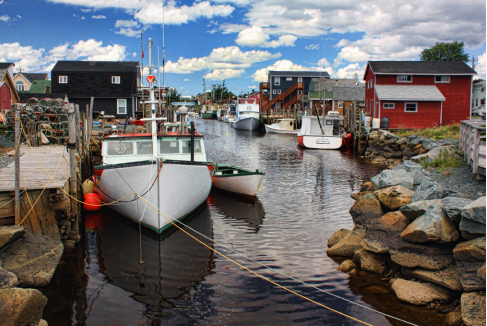
In 1996, Fisherman’s Cove, which combined a restored and working fishing village with gift shops and restaurants, opened as a tourist attraction.

Only 20 minutes from Downtown Halifax, Fisherman’s Cove is one of Nova Scotia’s oldest and newest tourist
destinations.

Enjoy the sounds of the ocean and views that’ll have you stopping for another yet another photo. Watch the fishermen come in with their daily catch; you can buy their fish right here! Take a boat ride and explore McNabs Island. You can also learn the great history of Fisherman’s Cove by enjoying a historic walk of the area.

If you like to shop, you’ll love the many shops of Fisherman’s Cove. There is a beautiful gallery where you can purchase the art of local artists and our other shops where you can purchase souvenirs, Maritime art crafts, unique folk art, and much more (visit our shops & services page).

As you wander through the shops you might see local artists capturing some of the spectacular vistas. While visiting, if you find yourself hungry, feast on fantastic seafood, tea & coffee, soups,desserts, or enjoy a delicious ice cream treat.

Local Attractions:

Enjoy scenic boat tours, romantic beach walks, bird
or whale watching
Tours are available for Devil’s or McNab’s Island
Visit the Ives Battery, Fort McNab or the lighthouse
Shark Fishing Adventure or deep sea fishing.
Golf Course, less than 5 minutes away
Shearwater Aviation Museum
Local artisan shops & Restaurants at Fisherman’s Cove

Comments Off on Eastern Passage

Cole Harbour

Cole Harbour, Nova Scotia

Cole Harbour is situated 6 kilometers east of the central business district of Dartmouth and takes its name from
Cole Harbour, a natural harbour fronting the Atlantic Ocean. The community is adjacent to and immediately east of the former city boundary of Dartmouth; prior to municipal amalgamation and the creation of the Halifax Regional Municipality in 1995, Cole Harbour was an unincorporated village within the Municipality of the County of Halifax.

The centre of Cole Harbour is at the intersection of Forest Hills Parkway and Route 207 (Cole Harbour Road).Highway 107 is easily accessible from the Forest Hills Parkway and Cole Harbour becomes Portland Street linking the community to Downtown Dartmouth and Highway 111.

Cole Harbour Place is a focal point of the community and is one of the finest independently run facilities in Nova Scotia. It caters to all sorts of activities including,Aquatics, Athletics, Skating and Yoga.

Located on the south-west corner of where Poplar Drive meets Otago Drive is the Cole Harbour Heritage Farm Museum, a community museum dedicated to preserving and interpreting Cole Harbour’s agricultural past. The Rose and Kettle Tearoom has been the heart of the Farm Museum for over 20 years. The menu is a blend of old English influences, Nova Scotia favourites, and recipes from old Cole Harbour kitchens, all created from scratch and using the Farm garden’s own produce

Notable People from Cole Harbour:

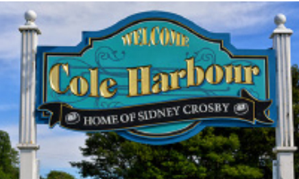
Sidney Crosby, National Hockey League Triple Gold Club
member, All-Star and 2-time Olympic Gold Medalist
Mike Clattenburg, Film director, writer and creator of
Trailer Park Boys
TJ Grant, UFC Lightweight fighter
Craig Hillier, Professional hockey player
Nathan MacKinnon, Professional hockey player
John Paul Tremblay, Actor, Trailer Park Boys
Robb Wells, Actor, Trailer Park Boys
Morgan Williams, International rugby player

(Some of the Many) Area Schools:

  • Auburn Drive High School
  • Cole Harbour District High School
  • Astral Drive Elementary School
  • Sir Robert Borden Junior High School
  • Astral Drive Junior High School
Comments Off on Cole Harbour

Centreville Area

Centreville, Nova Scotia

The community of Centreville is located on Route 359,which heads towards the North Mountain and is minutes away from the magnificent Bay of Fundy and the quaint fishing village of Hall’s Harbour. This friendly, safe community is a one-hour drive from Halifax and boasts a municipal sewer system and reasonable housing prices and tax rates

The central location of this family-oriented community makes for easy access to the towns of Kentville and Wolfville and the village of New Minas, and hence fine dining, live theater, Acadia University, shopping malls,and an excellent medical facility and services.

Centreville has a beautiful park with walking trails, a play ground, and well-equipped baseball and soccer fields.For golf enthusiasts there is Eagle Crest, a scenic 18-hole golf course. The Charles MacDonald Concrete Museum of Centreville is an interesting display of folk art in concrete.

DSCF0006The Centreville Community Hall is well used by the Centreville District Community Development Association (CDCDA), the Good Neighbour Club, Pins and Needles, and other community social and youth groups. The Good Neighbour Club hosts the “BIG Breakfast” every third Saturday, except July, August, October and December.

Local Area attractions include:

  • Miner’s Marsh – A popular nature trail
  • Cape Split Trail – One of Nova Scotia’s most famous coastal views
  • Prescott House Museum
  • Ross Farm Heritage Museum
  • The Tangled Garden – Beautiful gardens and tasty treats!

Local Schools:

  • Aldershot Elementary School
  • Kings County Academy
  • Glooscap Elementary School
  • Port Williams Elementary School
  • Nova Scotia Community College – Kingstec Campus

Comments Off on Centreville Area

Canning Medford

Canning, Nova Scotia

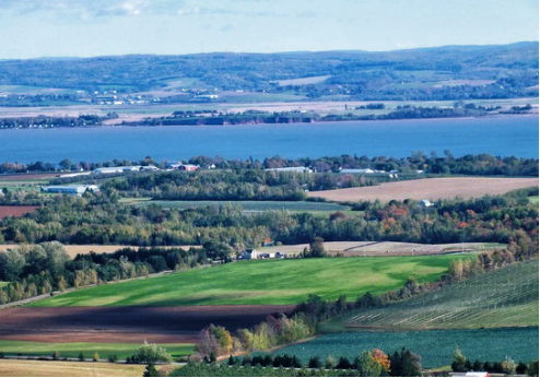
Canning is a small village of around 850 people near the base of the North Mountain. First settled by the Acadians it was later inhabited by the New England Planters and the Dutch. Canning was first known as Apple Tree Landing, a well known children centre in the community still bears that name.Canning is also home to one of the most well known scenic areas in the Annapolis Valley, the Look Off. From an elevation of roughly 200 metres you can see amazing views of the valley below. Another well known landmark in Canning is the statue in memory of Harold Borden, who died in the Boer war, which is believed to be the second oldest military monument in Nova Scotia.


The Borden Wharf Lighthouse which was built in 1904 was restored in 2004 and now resides behind the Canning library. The light was taken down in 1959, the light destroyed, and the base was used as a pig pen. It saw other uses along the way as well, for a while used as a tool shed and then a little more dignified use as a tourist bureau.


Medford Beach

Paddy’s Island on North Medford Beach was once tree-topped, but now barely maintains a tuft of grass atop the sandstone formation. Paddy’s Island was named for Patrick “Paddy” Burns, 1824-1882, a farmer who owned the property above the beach. He married Catherine Whalen of Chester. “Paddy” and his brother, John, were dairy farmers and neighbours. Many people do not realize that Paddy’s Island has also been the name given to the headlands at North Medford.As recently as 1950, the Medford Women’s Institute reported this curiosity, so when people say they lived at Paddy’s Island they mean the land not theisland. It is sometimes erroneously called Paddy Island.

Local Schools:

  • Glooscap Elementary School
  • North East Kings Education Centre

Comments Off on Canning Medford
Style Selector
Select the layout
Choose the theme
Preset colors
No Preset
Select the pattern